_______________________________________________________________________________________________________________________________________
Copyright © 2013 Ughtasar Rock Art Project Team. All rights reserved. V6 Jan 2016
The Study Area of the Ughtasar Rock Art Project (E46o03'10" N39o41'10) is tightly  defined by natural boundaries provided by the caldera of an ancient volcano known as Tsghuk, which forms part of the Tsghuk-Karckar group in the central part of the Syunik volcanic ridge. High jagged peaks form the south-western rim, with lower hills of red and black pumice to the north and east, perhaps from secondary volcanic events. A massive natural boulder ‘dam’ holds back a permanent glacial lake on the southern edge. Between wide areas of natural grassland and seasonal pools the floor of the crater is marked by heavily fractured basaltic lava flows. Smaller volcanic cones and magma spouts suggest minor volcanic events while polishing and striations on many of the boulders provide evidence of former glaciation.
At an elevation of about 3,300m the site comprises the base of the caldera, about 1.5km x1km in extent, together with the main approaches from the south and the north.
 Most of the petroglyphs are located in boulder streams around the permanent lake, seen to the right of the centre of the satellite image (left), others are scattered more thinly across large parts of the study area. The site is snowbound for much of the year, being accessible only from early-mid July until mid-late September. Four-wheel drive vehicles are essential to negotiate the 17km of rough track, climbing 1400m from the nearest settlement, the tiny village of Ishkanasar, itself a further 6km from the small town of Sisian. Even during the short summer interlude snow storms and rain can make the long and stony approach track virtually impassable.
Until quite recently the caldera served as valuable upland pasture for local herdsmen, its rich grassland dotted by stone-built enclosures, as yet undated but almost certainly providing night-time protection for livestock during the few months when grazing was possible. The enclosures vary in size, shape and complexity; most are relatively simple in plan, with one or more circular, oval or irregular 'compartments' defined by loosely built stone walls between 30 and 70cm in height. Some have proper closable entrances and small ‘cells’, presumably to provide shelter for the herders themselves.
Also present within the caldera are cairns, a number of stone-built ‘shelters’ and three possible burial mounds, as well as an apparent cemetery of short inhumation burials.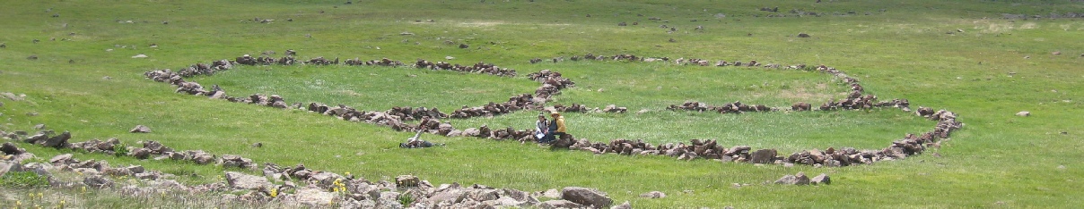
Reference: Satellite image courtesy of GEOEYE www.geoeye.com

Ughtasar Rock Art Project
Satellite photograph of Ughtasar Imagery source: GEOEYE-1, 2009